The Best Places for Backcountry Skiing in Truckee & Tahoe
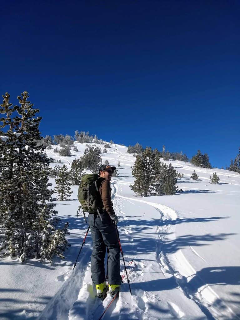
It should come as no surprise to hear that Lake Tahoe and Truckee have access to world class backcountry terrain. From the I-80 corridor to the shores of Lake Tahoe, there’s no shortage of peaks to climb and ski and our varied terrain provides opportunities for every kind of backcountry skier to get out and have fun. Whether you’re looking for a multi-day hut trip, a steep, extreme line, or a short and quick jaunt, you can find it here.
Mount Rose
Mount Rose has some of the highest elevation skiing in the Truckee Tahoe area making it a great choice for early season turns. This is a prime zone and there are a ton of tours, peaks and routes to choose in this area.
Skiing Mount Rose proper is a longer day than most of the other tours on this list. It’s 7 miles roundtrip with 2800 feet of vertical gain. The summit is usually wind scoured but the views from the top are worth the effort. There are many ski touring options in the Mount Rose area. For a shorter day, check out Tamarack Peak (described below), Relay Peak or Rose Knob.


Parking and Trailhead Directions – There are a number of ways to access Mt Rose proper either from the NDOT station on the Reno side or from the Tamarack trailhead. If starting on the NDOT (north side) cross the highway and start heading up towards the peak. From the Tamarack trailhead (see below) head up to the natural saddle just past Galena Peaks on your right. As you reach the small saddle, head down to the lower drainage and then up the south aspect of Mount Rose. The summit will come into view in front of you.
Tamarack Peak
Home to the popular Hourglass Bowl, Tamarack Peak has many short and sweet touring options.

This popular ski tour in the Mount Rose area has great skiing in all directions including the NE facing hourglass bowl. On the 1000 foot climb to the summit, you’ll get panoramic views of the Washoe Valley, Mount Rose, Lake Tahoe and Relay Peak. The easy access and straightforward climb make Tamarack a favorite in the Mount Rose area.

Parking and Trailhead Directions – To get to the trailhead from Lake Tahoe, head north on Hwy 431 from Hwy 28. A small plowed parking area is located about 8 miles northeast of Hwy 28, directly east of Tamarack Peak and close to Tamarack Lake.
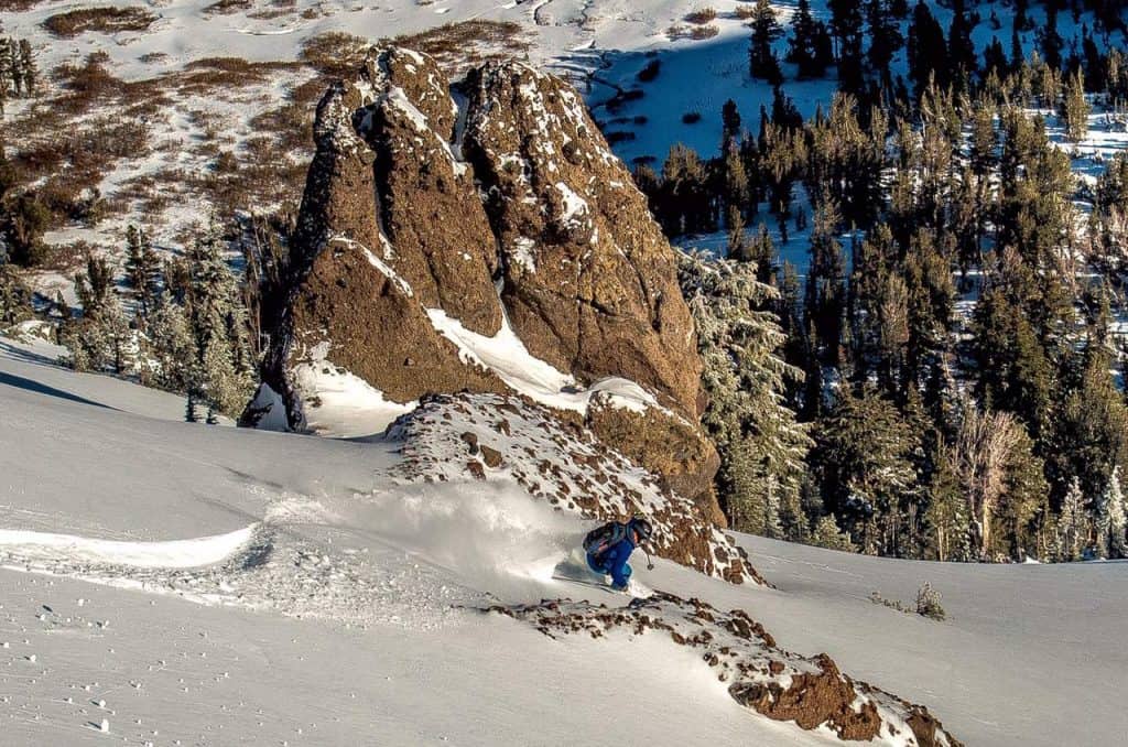
Jake’s Peak
Just south of Rubicon Peak on the west shore of Lake Tahoe, Jake’s Peak offers some of the best panoramic lake views to be had.

Depending on what route you take, Jake’s Peak is a 2 – 3 mile roundtrip tour with 2350 ft of vertical gain. At the summit you’re treated to phenomenal views of Lake Tahoe and Desolation Wilderness. Most people will ski the northeast aspect of this peak which tends to hold powder long after a storm. The name of this mountain is significant to Tahoe’s local history. It’s named after a popular Alpine Meadows ski patroller, Jake Smith, who died in the massive avalanche that hit the base of the ski resort in 1982.

Parking and Trailhead Directions – Recent California Department of Transportation construction to CA-89 has led to significant reduction in size of the parking pull out for Jake’s. There is usually a small, plowed out area just past the DL Bliss entrance on the east side of Highway 89. DO NOT BLOCK PLOW TURNAROUND AREAS, DO PARK OVER THE WHITE LINE AND IN GENERAL, BE VERY RESPECTFUL AND LAW ABIDING WITH YOUR PARKING OR YOU WILL GET A TICKET!
Rubicon Peak
Rubicon Peak is a classic Tahoe ski tour on the West Shore ridge line of Lake Tahoe.

Rubicon Peak is a beloved ski tour for many reasons. It’s the whole package: gorgeous views, reliable powder, and fun gladed skiing through an old growth forest. The climb is about 2200 ft to reach the summit of this peak. From there, the north and east aspects provide a fun descent to the car. For a longer day, take a quick lap down to Stony Ridge Lake to the southwest before heading back up to the summit.


Parking and Trailhead Directions – Parking can be challenging for this popular ski tour. There are a few pullouts along highway 89 south of County Road 2358 however these spots are subject to ticketing, especially when snow plowing is in progress. This is the easiest parking when snow removal operations are not active. Another option is at the top of Highview Drive which dead ends at the water tower. This option saves you about 600 vertical feet however it is in a residential neighborhood that is subject to ticketing, especially during snow removal. Again, be respectful and smart about your parking choices for this tour.
Mount Tallac
Nestled behind the gorgeous Emerald Bay, Mount Tallac is an iconic peak with rewarding views and a variety of ski descents.

Mount Tallac is a mammoth of a mountain that offers tons of terrain for backcountry skiers. This is a half day ski tour with 3200 feet of vertical gain. From the summit, you have a variety of descent options – ski the upper NE bowl for a direct line to your car, lap the south facing bowls for springtime corn, or set up a car shuttle and ski down to Fallen Leaf Lake. There are a number of extreme lines directly east of the summit, however cliffs and rocks bands make this route hazardous for all but the most experienced skiers.
Parking and Trailhead Directions – The parking area for Mount Tallac is a pullout along Hwy 89, near the junction to Spring Creek Road. You’ll have to walk through this gated community to get to the end of Spring Creek Road where the trail begins.
Castle Peak
Located off of I-80, Castle Peak is a popular ski tour thanks to easy access and a wide variety of terrain.

From the trailhead, you can do a quick lap on Andesite Mountain, head to Castle Peak or continue straight over the pass to the Peter Grubb Hut. Castle Peak’s southern aspect offers fun glades and open slopes that are a favorite for springtime corn skiing. It’s north slopes take a bit more effort to reach but reward you with soft snow and steeper descents. When it fills in, the main south facing couloir from the summit is a must do classic for the area.

Parking and Trailhead Directions – Take the Exit 176 off of I-80 for Boreal / Castle Peak and park on the south side of the highway. You will need a season or daily SNO-PARK pass to park here which are available to purchase at Tahoe Mountain Sports. The trailhead is located on the north side of the highway. To get there, walk towards the off ramp and continue north under the highway overpass. From there you’ll see the trailhead directly ahead.
Remember to check the daily avalanche forecast from Sierra Avalanche Center, stay up date on avalanche education by taking an AIARE course from Tahoe Mountain School, and always Recreate Responsibly.
Backcountry Huts
Keep up to date on COVID restrictions for backcountry huts in this area, including Benson Hut, Bradley Hut, Peter Grubb Hut, and Ludlow Hut.
Are you ready to go skiing? Rent from us and reserve your backcountry gear today!
Learn more about our backcountry rentals here.
Share this
Popular posts


Leave a comment